A press release by Bill Macpherson, public information officer for the Regional District of Central Kootenay’s Emergency Operations Centre, said that warning signs include “increase in height and intensity of water flows, mudslides, debris in creeks, colour changes in water or leaning trees. Exercise extreme caution on banks of rivers and streams as they are likely saturated and potentially unstable and dangerous.
“At times like this, take extra care when driving especially on rural or unfamiliar road — all roads look different with standing water or water running over them. Do not drive into flooded areas — you and your vehicle can be quickly swept away. Do not walk through any moving water — less than 15 cm (six inches) is enough to make you fall. Walk where there is no standing or moving water, footing is solid and watch for tripping hazards.”
Kootenay Lake is also experiencing some of its highest levels.
“Residents should be aware the latest projections for Kootenay Lake could see a peak level of 1754 feet or slightly higher,” said a press release by Bill Macpherson, public information officer for the Regional District of Central Kootenay’s Emergency Operations Centre. “Currently, the lake is at 1753.1 feet. This forecast is dependent on weather patterns, inflow and discharge amounts from dams on the Columbia-Kootenay river system over the next few days.”
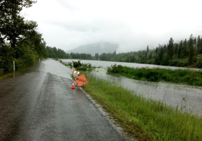
A state of local emergency remains in place in RDCK Area C, where Ministry of Transportation and Infrastructure (MOTI) and Yellowhead Road and Bridge (YRB) crews have been improving a West Creston MOTI right-of-way off Smith Road with loads of gravel and brushing. Kootenay River flooding resulted in West Creston’s Peterman Road being closed completely. Parts of the road are covered to a depth of 12 inches. The alternate route was most easily accessible with four-wheel-drive vehicles before crews improved it.
An evacuation alert for 35 homes and a state of local emergency were declared on Wednesday in West Creston, an area that has seen additional flooding at the Creston Valley Wildlife Management Area.
Designated fire stations throughout the RDCK have sandbags available for emergency use by property owners in affected areas.
For more information on personal/family preparedness including details on proper sandbagging techniques, visit the Provincial Emergency Program website, www.pep.bc.ca.
For information on river levels, visit http://bcrfc.env.gov.bc.ca/warnings.
For Kootenay Lake Levels, visit www.fortisbc.com/Electricity/CustomerService/KootenayLakeLevels.
For RDCK public notices, visit http://www.rdck.bc.ca/publicinfo/notices.html.
To report a flooding emergency or event call 1-800-663-3456 or contact the EOC at 1-877-552-7701.