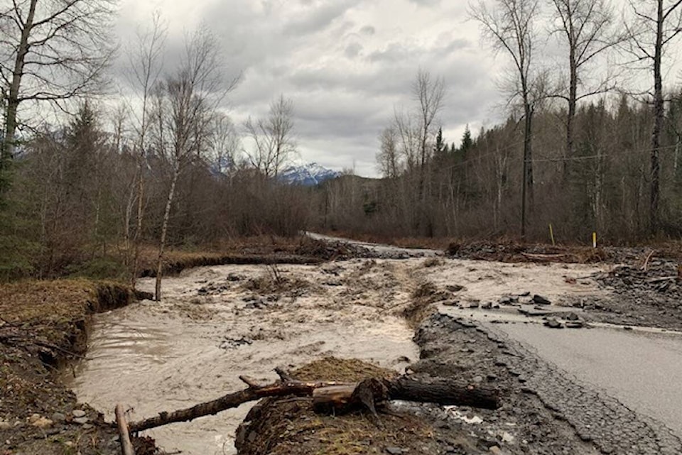
A high streamflow advisory has been issued for the Kootenay and Upper Columbia region due to a high volume of forecasted rainfall in the coming days across the BC Interior.
The advisory covers waterways and tributaries such as the Elk River, Duncan River and St. Mary River in the East Kootenay, as well as lower elevation and valley bottom tributaries in the West Kootenay and Upper Columbia regions, including Revelstoke and Golden.
The advisory was issued by the BC River Forecast Centre Saturday (Nov. 27) evening, as another atmospheric river moves from the coastal areas through the interior.
“River levels are expected to rise Sunday into Monday, with the potential for second peaks into later next week as the second system drops precipitation on the BC Interior,” reads the advisory. “Warming temperatures during these events is anticipated to lead to significant snowmelt at lower and valley bottom elevations, leading to rain-on-snow runoff in smaller tributaries.”
Other parts of the province, particularly Vancouver Island, the Sunshine Coast and the Sumas Prairie are under flood watches or flood warnings.
The Regional District of East Kootenay is urging residents to use extreme caution around local waterways.
“With the forecast calling for a series of rain events over the next few days, it is critical that residents be aware and prepared,” said Information Officer, Loree Duczek. “From staying away from local creeks and waterways, to making sure you are registered for the Regional Evacuation Notification System, sandbagging if you live in flood-prone areas, and having a grab and go kit and emergency plan ready, there are several things we can do to be proactive in the event we experience localized flooding as a result of the forecasted rain.”
For breaking information on evacuation alerts or orders in the East Kootenay, visit the RDEK website.
Sandbagging stations have been set up in the following locations:
• Hosmer – Elk River Hostel/Pub – Hwy 3 at 6th Avenue (in the lot south of the pub)
• Fernie – 1350 Railway Avenue, corner of Railway Ave & Ridgemont Ave
• Cranbrook – Next to Public Works Yard, 201 Cobham Avenue
The Regional District of Central Kootenay also encouraged residents to be aware of conditions and be prepared in case of an emergency.
“Having watched what has occurred throughout the province over the last couple of weeks, it is imperative residents take these warnings seriously and know what risks exist in and around their community,” said Chris Johnson, RDCK Manager of Community Sustainability. “At this point, the best strategy is to stay informed by monitoring the local weather and current stream flows.”
For breaking information on evacuation alerts or orders in the West Kootenay, visit the RDCK website.
The RDCK also noted the risk of debris flow and rock fall during heavy rainfall or rapid snowmelt events, and that landslides and floods can be reported to the Provincial Emergency Coordination centre by calling1-800-663-3456.