There are basically four trails on Mount Thompson and its slopes that are suitable to the tastes of most hikers. They are the Mount Thompson Rim Trail, the Sullivan Creek “trail”, the old Mount Thompson lookout Pack Trail, and the Rotary Connector Trail. Another trail used mostly by four-wheelers takes off from the Mount Thompson Forest Service Road (FSR) opposite the junction of the Sullivan Creek Trail with the FSR just before the eight-kilometre marker. This one-and-a-half-hour return meanders over an old road down the northwest shoulder of Mount Thompson through dense forest dead ending in the bush. Along the way there are a couple of viewpoints overlooking the northeast shoulder of Mount Thompson.
 People take an additional route through a pullout and along an old road to the north from kilometre 1 on the FSR. This trail, which may go over some private property, ends up above the CPR tracks along the Goat River, two hours return. Now back to the more popular trails.
The Rim Trail, for those of you who are not familiar with it, takes off from the north peak of the Thompson range at the end of the Mount Thompson FSR and leads along the range to the south peak, identifiable by a missile-like capsule housing some electronic equipment. The route, over several humps, one having a fairly steep ascent, would probably be rated as a one-and-a-half- to two-hour hike one way. The south peak is 2,176 metres (7,139 feet) in elevation, while the north peak is lower at about 2,137 metres (7,011 feet).
The view from the south peak is a 360-degree panoramic view from the Kootenay River valley up to the tops of Idaho Peaks, Fisher and Parker, Creston Mountain to the west, Haystack Mount to the north and, on a clear day, Fisher Peak and the Rockies to the north east over near Cranbrook.
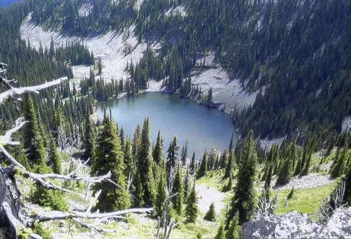
The Sullivan Creek route is along an old logging road that may have been built around 1948. It takes off to the right from the FSR just below kilometre 2. It immediately crosses Sullivan Creek (no bridge) following along to the south and then swinging easterly along the north facing slope south of Sullivan Creek. After a number switchbacks and a long stretch eastward, it joins the FSR around kilometre 8. The elevation gain is about 749 metres (3,113 feet).
A main feature of this trail, a much grown-in old road, is that one can hike a loop up to the end and down the road to the starting point. One could also get picked up or dropped off at the top end and still get in a good two- or three-hour hike. In good winter snow conditions, it might also make a nice ski. Somewhere near the top end of this trail, on the top side of the trail and within a kilometre of the FSR is an old concrete cistern possibly used as a water source for the earlier fire lookouts.
Now for some details on the historic Pack Trail: Like the Sullivan Creek trail, it begins just below kilometre 2 on the FSR at the little pullout but takes off immediately (30 feet) to the left and up. It appears that the trail proceeds straight up but the original route, at 130 feet from the trailhead, actually goes to the right, then switchbacks to the left, crossing the apparent route, and then switchbacks to the right to continue on the original trail.
The Pack Trail, a historic supply line to earlier fire lookouts, comprises only a portion, 3.2 kilometres/two miles, of the original 1930s trail. Some of the unlocated top end was obliterated by the construction of the FSR around 1958.
After a number of switchbacks up the slope, above and north of Sullivan Creek, the Pack Trail connects with the Mount Thompson FSR at around 5.4 kilometres. Some hikers ascend this trail and then hike down the FSR. It is also possible, on the way down, to take the Rotary Connector Trail back to the Pack Trail, intersecting it at 1.1 kilometres/0.7 miles. Either way, the jaunt would be around three hours. Near the top of the Pack Trail there is a place to have lunch with a nice view of the valley below. The trail was originally graded for pack animals, so now is a comfortable hiking slope, thanks to 17 switchbacks.
Historic aspects outside of the Pack Trail itself are remnants of the lookout telephone line and a cabin site with some stove parts. The trail passes through a shady mixed forest of large cedar, Douglas fir and giant hemlock trees. Snowberry, mock orange, mallow ninebark, Oregon grape, mountain maple, typical flowers and a few rare plants grace the trail sides and more open areas. It crosses the bottoms of several rock scree slopes topped by low cliffs. One will come across several boulders on the trail that loosed from above since the trail was constructed in the early 1930s.
The Rotary Connector Trail, at 1.1 kilometres/0.7 miles, is a new trail connecting, from near kilometre 3 on the Mount Thompson FSR with the Pack Trail. The trail head may also be located as being at the second left-hand curve past kilometre 2 on the FSR. This narrow trail, with eight switchbacks on the east portion, contours a steep slope providing, from a viewpoint, lunch spot and comfortable bench, a spectacular view of the Creston Valley.
Any of these trails, except the Rim Trail, can, in a normal year, often be hiked right into November. They may also provide interesting jaunts in six inches of snow or, otherwise, perhaps, on snowshoes (except the Rotary Connector Trail). However, anytime of year, anybody using trails anywhere does so at their own risk and should take clothing, footwear, food and equipment suitable for the time of year and the place. Weather conditions can change pretty fast on the Rim Trail. Lack of enjoyment and comfort on a hike is often due to underestimating the weather and length of trip!
The information about these trails is rather general, so apply accordingly. However, I hope it will be helpful.
Ed McMackin is a biologist by profession but a naturalist and hiker by nature. He can be reached at 250-866-5747.